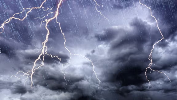
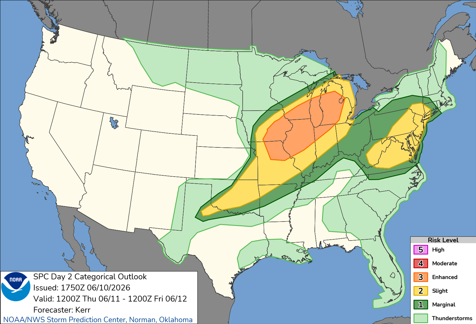
Thursday outlook looks active
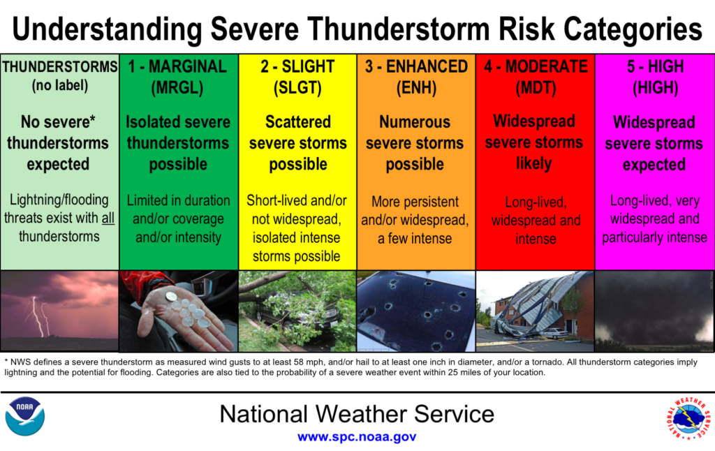
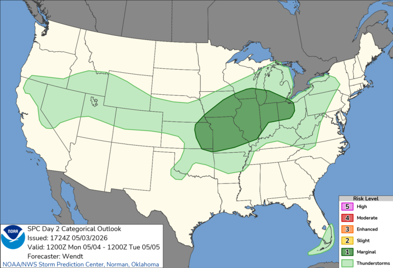
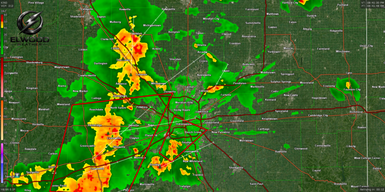
The National Weather Service has placed most of Central Indiana into a Level 2/Slight threat for Thursday June 11th, 2026. High heat indices approaching the 100° mark is in store with more humidity to fuel unstable air. A line or complex of thunderstorms will arrive in central Indiana late evening Thursday or early Friday AM. Storms could be severe and we update as storms begin to organize.
Strong to severe thunderstorm development, including one or two organizing clusters, will probably be accompanied by the potential for large hail, damaging wind gusts and perhaps a couple of strong tornadoes in a corridor across the Midwest into Great Lakes region Thursday through Thursday night.
NOAA STORM PREDICTION CENTER