Hurricane Lala
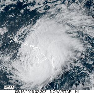
Hurricane Lala intensified into a Category 1 storm, lashing Hawaii’s Big Island with maximum sustained winds of 75 mph. Located roughly 35 miles south of South Point, the storm is fueling severe rainbands, creating massive power outages, and causing dangerous flooding across the state. Hawaii Governor Josh Green has ordered residents to shelter in place immediately.
Current Storm Details & Track
- Wind Speeds: Maximum sustained winds at 75 mph, with gusts reaching up to 154 mph at the summit of Mauna Kea.
- Movement: Moving northwest at about 8–9 mph while interacting directly with the Big Island’s mountainous terrain.
- Projected Path: The storm core is expected to hug the southern end of the Big Island before making a sharp westward turn on Sunday, keeping the center south of the smaller islands.
Severe Regional Impacts
- Power Grid Damage: More than 68,000 customers have lost power across the state, with the vast majority concentrated on the Big Island and Maui.
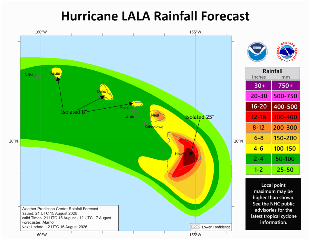
- Torrential Rainfall: Parts of the Big Island have already recorded over 16 inches of rain, with local forecasts predicting up to 25 inches in higher terrains, triggering life-threatening flash floods and mudslides.
- Travel Disruption: The Hawaii Department of Transportation completely closed both Hilo International Airport (ITO) and Kona International Airport (KOA), leading to extensive flight cancellations stretching back to Los Angeles (LAX).
Current Warnings & Evacuations
- Hurricane Warning: Remains active for Hawaii County (Big Island).
- Tropical Storm Warning: Enforced for Maui County, Oahu, and Kauai County as outer rainbands spread westward.
- Evacuation Hubs: Temporary Evacuation Points (TEPs) are now fully operational on Maui, and public shelters have opened across every county on the Big Island.
For live tracking updates and official shelter lists, residents should monitor the Hawaii Emergency Management Agency or check real-time notifications on HNL Alert.