Fathers Day storm chances
Chances for severe thunderstorms will return Sunday afternoon and continue Sunday night. Damaging winds and isolated tornadoes are the primary severe threats. Heavy rain and localized flooding are also possible.
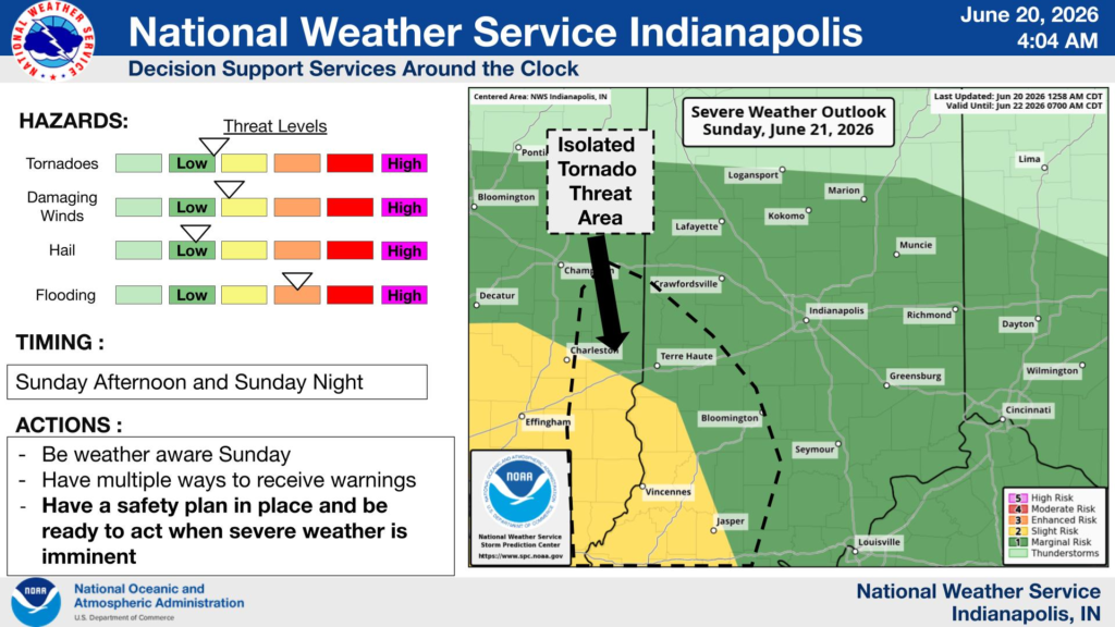
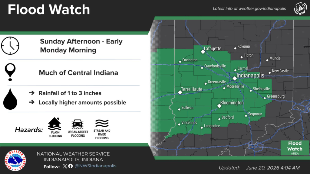
Chances for severe thunderstorms will return Sunday afternoon and continue Sunday night. Damaging winds and isolated tornadoes are the primary severe threats. Heavy rain and localized flooding are also possible.

Saturday, the NWS Storm Prediction Center, has Madison County under a level 1 risk of isolated storms with strong wind gusts. Large amounts of moisture in the atmosphere will likely bring brief heavy rainfall in the early evening, around 5pm. With a little bit of luck, these storms should push through prior to the 10pm…

As a cold front moves through Sunday afternoon, cooler more pleasant temps will grace us on Monday. Monday will be the best day of the week weather wise with low humidity and temp topping out in the low 70’s. Tuesday daytime will be sunny into the afternoon with temps rising into the mid 70’s. Tuesday…
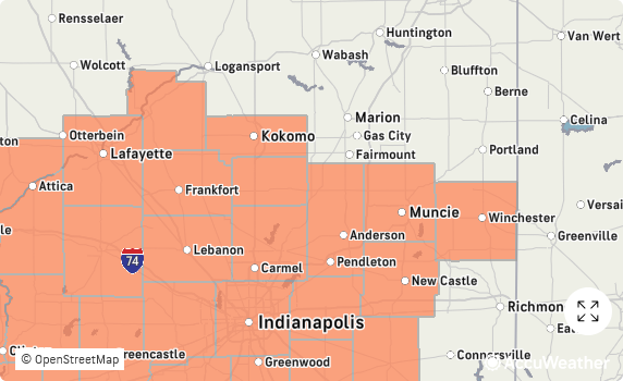
This weekend was only a taste of what’s to come this week. Temperatures and humidity are going to get uncomfortable to say the least. Dangerous heat indices will persist through the July 4th weekend. Monday through Thursday will be the warmest with heat indexes 100°-107°, sparking the National Weather Service to issue a Heat Advisory….
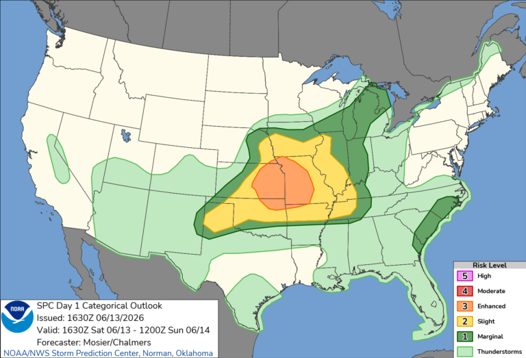
Saturday will be seasonally warm topping out in the mid 80’s in the afternoon. The afternoon humidity is going to be noticeable but not anywhere near what we experienced earlier in the week. Most of central Indiana is in a Level 1 (Marginal) range for Saturday evening according the SPC. Pop-up storms are possible here…
Isolated strong to severe storms are possible on Friday afternoon into early evening. Damaging winds are the primary severe threat. On Monday, a stronger system will bring a better chance for severe thunderstorms from late afternoon into the overnight.

Each year, the summer solstice marks an important turning point in Earth’s journey around the Sun. In 2026, the summer solstice occurs on June 21, bringing the longest day and shortest night of the year to the Northern Hemisphere. For thousands of years, people have observed and celebrated this moment. Today, the summer solstice remains an opportunity to better understand how Earth’s movements shape the…