Fathers Day storm chances
Chances for severe thunderstorms will return Sunday afternoon and continue Sunday night. Damaging winds and isolated tornadoes are the primary severe threats. Heavy rain and localized flooding are also possible.
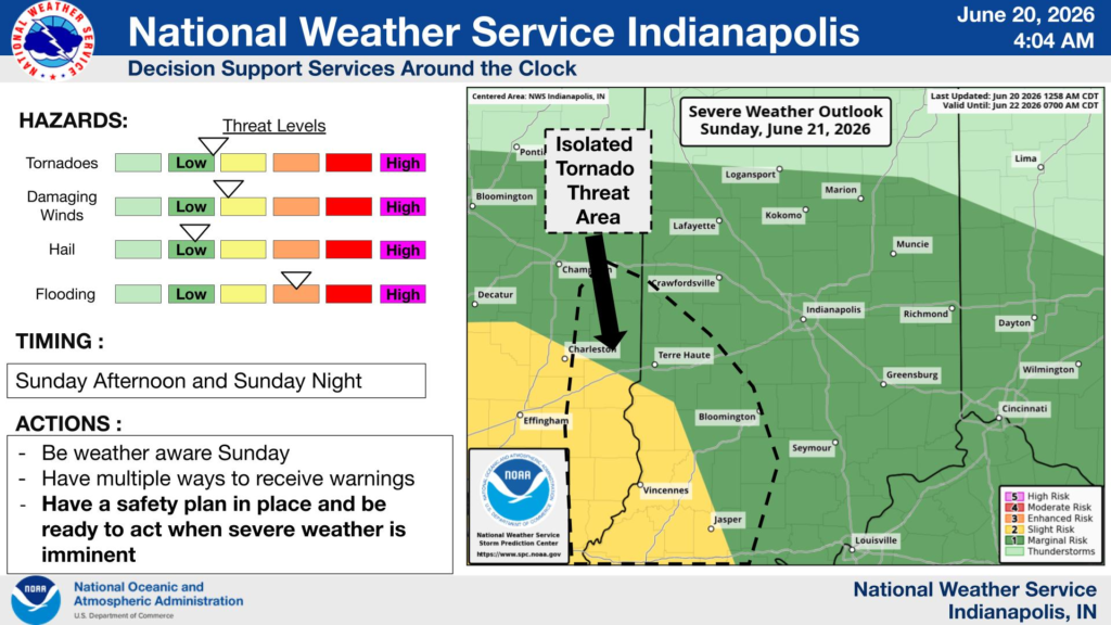
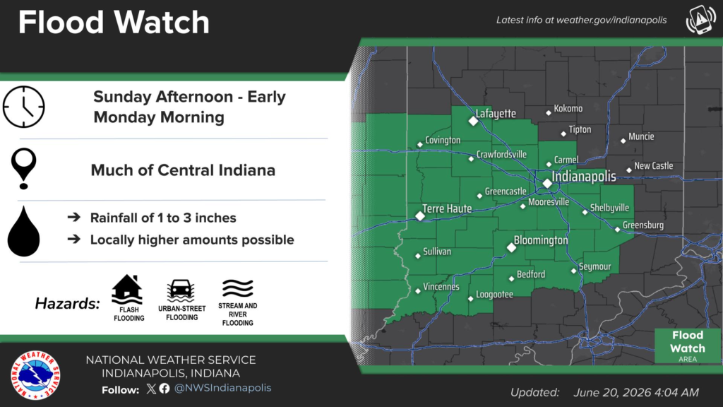

Chances for severe thunderstorms will return Sunday afternoon and continue Sunday night. Damaging winds and isolated tornadoes are the primary severe threats. Heavy rain and localized flooding are also possible.
The NWS Storm Prediction Center has western Indiana under a Level 3 risk for severe storms Monday evening. Storms will likely weaken as they move east with the rest of Indiana currently under a Level 2 risk. The first wave of scattered thunderstorms will begin to emerge after 1:00 pm Monday. After the first wave,…

Hot and humid today with heat indices near 100. Showers and thunderstorms are possible across Indiana later today that could drop south into Madison and Tipton Counties. Storms could produce strong/damaging winds and locally heavy rain.
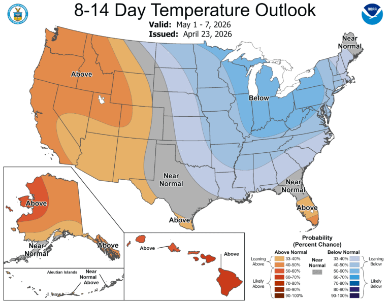
Early May 2026 is trending colder than average across Indiana, bringing risks of frost, especially in the northern region. Low temperatures may dip below 35°, requiring growers to monitor crops closely. While, according to data from the National Weather Service, the average last freeze in Central Indiana is mid-April, late-season freezes can still occur, such…
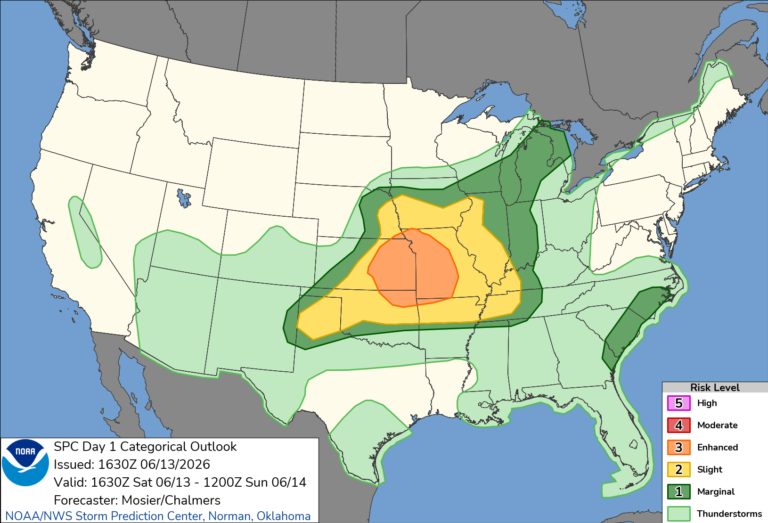
Saturday will be seasonally warm topping out in the mid 80’s in the afternoon. The afternoon humidity is going to be noticeable but not anywhere near what we experienced earlier in the week. Most of central Indiana is in a Level 1 (Marginal) range for Saturday evening according the SPC. Pop-up storms are possible here…
Isolated strong to severe storms are possible on Friday afternoon into early evening. Damaging winds are the primary severe threat. On Monday, a stronger system will bring a better chance for severe thunderstorms from late afternoon into the overnight.
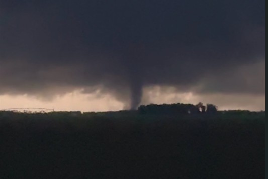
Tornado in Wanatah, IN
(@Zbarkerwx)