
Summer isn’t ready to give up yet
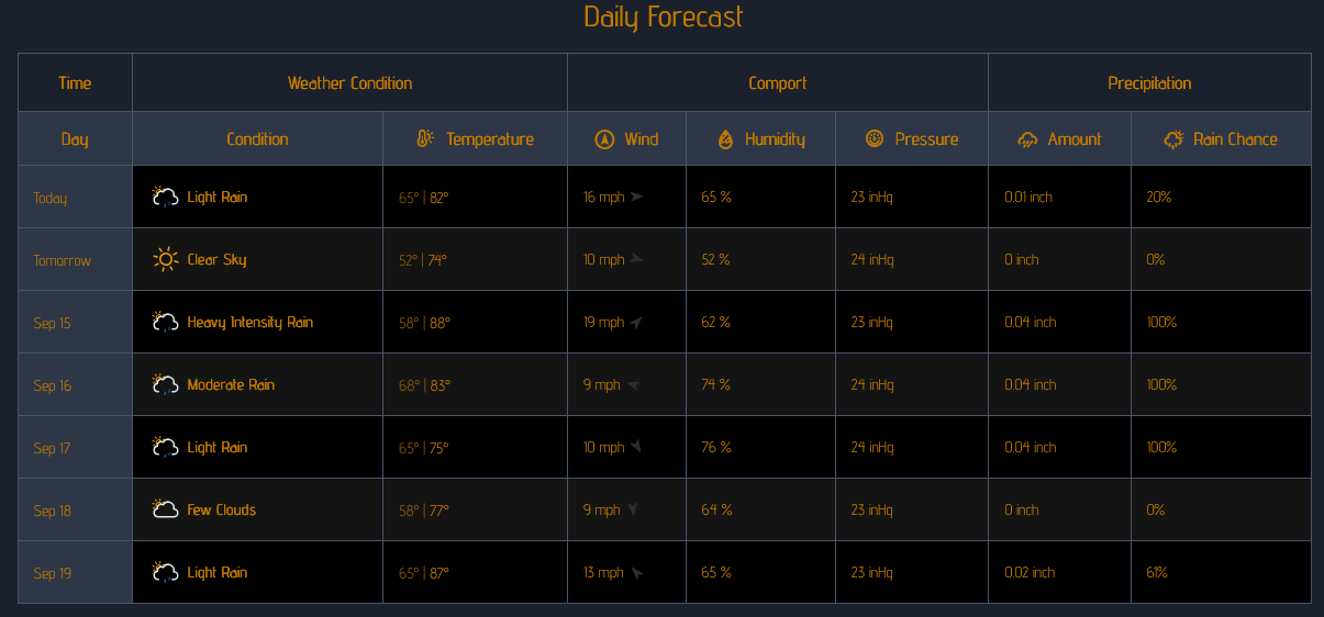
We can expect a week of changing weather conditions as summer-like warmth briefly returns before temperatures moderate heading into the weekend.
The week begins on a relatively pleasant note Sunday, with partly sunny skies and breezy conditions. Temperatures will remain comfortable, but a noticeable cool-down arrives Monday as humidity decreases and cooler air settles across central Indiana.
Warmth returns quickly Tuesday, with temperatures climbing into the upper 80s. Increasing humidity will also return, and there is a chance for a thunderstorm late Tuesday afternoon. The unsettled pattern continues Wednesday and Thursday, when warm and humid conditions could produce scattered showers and thunderstorms.
By Friday, conditions should become somewhat quieter, although humidity will remain noticeable. Saturday looks to remain warm with a mixture of sunshine and clouds.
Looking Ahead
The most significant weather story of the week will be the sharp temperature swings. After Monday’s cooler conditions, temperatures are expected to surge back toward the upper 80s Tuesday before settling into the lower to middle 80s for much of the remainder of the week.
The best opportunities for showers and thunderstorms appear to be Tuesday through Thursday, although widespread severe weather is not currently indicated.
A cooler pattern is expected to develop around Sunday, September 20, when temperatures could fall back into the upper 60s during the afternoon.